


thorame basse 13

dadodeca
User
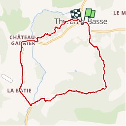

Length
9.5 km

Max alt
1340 m

Uphill gradient
356 m
Km-Effort
14.3 km

Min alt
1062 m

Downhill gradient
357 m
Boucle
Yes
Creation date :
2017-08-06 00:00:00.0
Updated on :
2017-08-06 00:00:00.0
2h48
Difficulty : Easy

FREE GPS app for hiking
 SityTrail
IGN / Geographical institutes
SityTrail Plus
The world is yours!
About
Trail Walking of 9.5 km to be discovered at Provence-Alpes-Côte d'Azur, Alpes-de-Haute-Provence, Thorame-Basse. This trail is proposed by dadodeca.
Description
trop de route.
Positioning
Country:
France
Region :
Provence-Alpes-Côte d'Azur
Department/Province :
Alpes-de-Haute-Provence
Municipality :
Thorame-Basse
Location:
Unknown
Start:(Dec)
Start:(UTM)
299937 ; 4884957 (32T) N.
Comments