


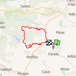
Circuit des sommets de Cabrieres

mouss65
User

Length
26 km

Max alt
408 m

Uphill gradient
585 m
Km-Effort
34 km

Min alt
78 m

Downhill gradient
584 m
Boucle
Yes
Creation date :
2017-08-07 00:00:00.0
Updated on :
2017-08-07 00:00:00.0
2h40
Difficulty : Difficult

FREE GPS app for hiking
 SityTrail
IGN / Geographical institutes
SityTrail Plus
The world is yours!
About
Trail Mountain bike of 26 km to be discovered at Occitania, Hérault, Fontès. This trail is proposed by mouss65.
Positioning
Country:
France
Region :
Occitania
Department/Province :
Hérault
Municipality :
Fontès
Location:
Unknown
Start:(Dec)
Start:(UTM)
530662 ; 4821719 (31T) N.
Comments
parcours très complet