


du vvf à saint-Didier

carolineF11
User

Length
9.3 km

Max alt
873 m

Uphill gradient
233 m
Km-Effort
12.4 km

Min alt
671 m

Downhill gradient
234 m
Boucle
Yes
Creation date :
2018-04-16 20:10:43.408
Updated on :
2018-04-16 20:10:43.408
2h39
Difficulty : Easy

FREE GPS app for hiking
 SityTrail
IGN / Geographical institutes
SityTrail Plus
The world is yours!
About
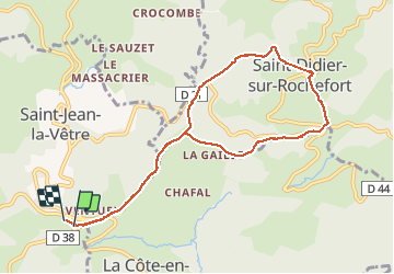
Trail Walking of 9.3 km to be discovered at Auvergne-Rhône-Alpes, Loire, Saint-Jean-la-Vêtre. This trail is proposed by carolineF11.
Positioning
Country:
France
Region :
Auvergne-Rhône-Alpes
Department/Province :
Loire
Municipality :
Saint-Jean-la-Vêtre
Location:
Unknown
Start:(Dec)
Start:(UTM)
562817 ; 5069516 (31T) N.
Comments