


5 canal de bourgogne Montbard

BrassensJC
User

Length
24 km

Max alt
308 m

Uphill gradient
81 m
Km-Effort
25 km

Min alt
209 m

Downhill gradient
169 m
Boucle
No
Creation date :
2017-08-09 00:00:00.0
Updated on :
2017-08-09 00:00:00.0
5h00
Difficulty : Medium

FREE GPS app for hiking
 SityTrail
IGN / Geographical institutes
SityTrail Plus
The world is yours!
About
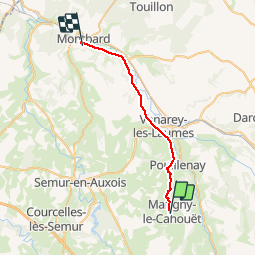
Trail Walking of 24 km to be discovered at Bourgogne-Franche-Comté, Côte-d'Or, Marigny-le-Cahouët. This trail is proposed by BrassensJC.
Description
Courses à Venarey les Laumes.
hôtel de la gare à Montbard
Positioning
Country:
France
Region :
Bourgogne-Franche-Comté
Department/Province :
Côte-d'Or
Municipality :
Marigny-le-Cahouët
Location:
Unknown
Start:(Dec)
Start:(UTM)
609917 ; 5257553 (31T) N.
Comments