


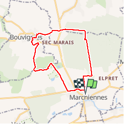
Marchiennes Bouvignies

BRASSENS
User

Length
13.1 km

Max alt
30 m

Uphill gradient
57 m
Km-Effort
13.8 km

Min alt
14 m

Downhill gradient
56 m
Boucle
Yes
Creation date :
2017-08-13 00:00:00.0
Updated on :
2017-08-13 00:00:00.0
2h59
Difficulty : Medium

FREE GPS app for hiking
 SityTrail
IGN / Geographical institutes
SityTrail Plus
The world is yours!
About
Trail Walking of 13.1 km to be discovered at Hauts-de-France, Nord, Marchiennes. This trail is proposed by BRASSENS.
Positioning
Country:
France
Region :
Hauts-de-France
Department/Province :
Nord
Municipality :
Marchiennes
Location:
Unknown
Start:(Dec)
Start:(UTM)
519938 ; 5584126 (31U) N.
Comments