


Refuge Albert 1er par Col de Balme

gregou74
User
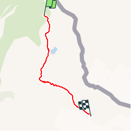

Length
3.9 km

Max alt
2695 m

Uphill gradient
520 m
Km-Effort
9.2 km

Min alt
2198 m

Downhill gradient
32 m
Boucle
No
Creation date :
2019-04-27 13:17:09.521
Updated on :
2019-04-27 13:17:09.558
2h19
Difficulty : Unknown

FREE GPS app for hiking
 SityTrail
IGN / Geographical institutes
SityTrail Plus
The world is yours!
About
Trail Walking of 3.9 km to be discovered at Auvergne-Rhône-Alpes, Upper Savoy, Chamonix-Mont-Blanc. This trail is proposed by gregou74.
Description
Prendre le Télésiège de Charamillon puis le télésiège des Autannes.
Passage par le Lac de Charamillon.
Positioning
Country:
France
Region :
Auvergne-Rhône-Alpes
Department/Province :
Upper Savoy
Municipality :
Chamonix-Mont-Blanc
Location:
Unknown
Start:(Dec)
Start:(UTM)
342915 ; 5098336 (32T) N.
Comments