


Alpinisme - Aller Simple - Tête Blanche par le Refuge Albert 1er

gregou74
User

Length
3.5 km

Max alt
3391 m

Uphill gradient
718 m
Km-Effort
10.7 km

Min alt
2670 m

Downhill gradient
0 m
Boucle
No
Creation date :
2019-04-27 13:17:08.082
Updated on :
2019-04-27 13:17:08.81
2h28
Difficulty : Medium

FREE GPS app for hiking
 SityTrail
IGN / Geographical institutes
SityTrail Plus
The world is yours!
About
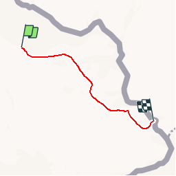
Trail Walking of 3.5 km to be discovered at Auvergne-Rhône-Alpes, Upper Savoy, Chamonix-Mont-Blanc. This trail is proposed by gregou74.
Positioning
Country:
France
Region :
Auvergne-Rhône-Alpes
Department/Province :
Upper Savoy
Municipality :
Chamonix-Mont-Blanc
Location:
Unknown
Start:(Dec)
Start:(UTM)
344037 ; 5095636 (32T) N.
Comments