


Pradelles-Naussac

Spinnaker
User

Length
17.9 km

Max alt
1139 m

Uphill gradient
229 m
Km-Effort
22 km

Min alt
899 m

Downhill gradient
412 m
Boucle
No
Creation date :
2017-08-16 00:00:00.0
Updated on :
2017-08-16 00:00:00.0
3h00
Difficulty : Medium

FREE GPS app for hiking
 SityTrail
IGN / Geographical institutes
SityTrail Plus
The world is yours!
About
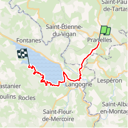
Trail Other activity of 17.9 km to be discovered at Auvergne-Rhône-Alpes, Haute-Loire, Pradelles. This trail is proposed by Spinnaker.
Positioning
Country:
France
Region :
Auvergne-Rhône-Alpes
Department/Province :
Haute-Loire
Municipality :
Pradelles
Location:
Unknown
Start:(Dec)
Start:(UTM)
569848 ; 4957556 (31T) N.
Comments