


Transsemoisienne 2017 tracé 2eme jour

alfreson
User
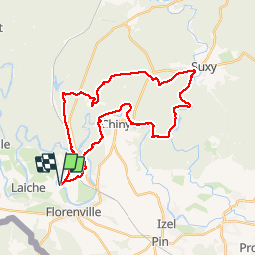

Length
31 km

Max alt
443 m

Uphill gradient
633 m
Km-Effort
40 km

Min alt
292 m

Downhill gradient
633 m
Boucle
Yes
Creation date :
2017-08-17 00:00:00.0
Updated on :
2017-08-17 00:00:00.0
4h48
Difficulty : Easy

FREE GPS app for hiking
 SityTrail
IGN / Geographical institutes
SityTrail Plus
The world is yours!
About
Trail Equestrian of 31 km to be discovered at Wallonia, Luxembourg, Florenville. This trail is proposed by alfreson.
Description
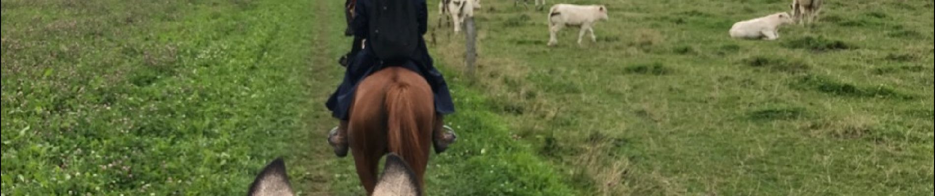
Magnifique promenade dans nos forêts ardennaises et le long de la Semois, avec plusieurs gués et de très longs galops.
Photos


Positioning
Country:
Belgium
Region :
Wallonia
Department/Province :
Luxembourg
Municipality :
Florenville
Location:
Lacuisine
Start:(Dec)
Start:(UTM)
665918 ; 5509067 (31U) N.
Comments