


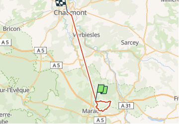
balade a faverolles

carolineF11
User

Length
30 km

Max alt
449 m

Uphill gradient
486 m
Km-Effort
37 km

Min alt
262 m

Downhill gradient
538 m
Boucle
No
Creation date :
2018-04-16 21:10:26.841
Updated on :
2018-04-16 21:10:26.841
3h56
Difficulty : Easy

FREE GPS app for hiking
 SityTrail
IGN / Geographical institutes
SityTrail Plus
The world is yours!
About
Trail Walking of 30 km to be discovered at Grand Est, Haute-Marne, Faverolles. This trail is proposed by carolineF11.
Positioning
Country:
France
Region :
Grand Est
Department/Province :
Haute-Marne
Municipality :
Faverolles
Location:
Unknown
Start:(Dec)
Start:(UTM)
665062 ; 5312850 (31T) N.
Comments