


20170822-Pont St pierre

doudet
User
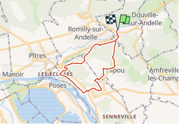

Length
12.7 km

Max alt
154 m

Uphill gradient
356 m
Km-Effort
17.5 km

Min alt
7 m

Downhill gradient
356 m
Boucle
Yes
Creation date :
2018-09-11 09:10:53.407
Updated on :
2018-09-11 09:10:53.407
3h54
Difficulty : Medium

FREE GPS app for hiking
 SityTrail
IGN / Geographical institutes
SityTrail Plus
The world is yours!
About
Trail Walking of 12.7 km to be discovered at Normandy, Eure, Pont-Saint-Pierre. This trail is proposed by doudet.
Description
Boucle A-R au départ du Chateau de Pont ST Pierre
Positioning
Country:
France
Region :
Normandy
Department/Province :
Eure
Municipality :
Pont-Saint-Pierre
Location:
Unknown
Start:(Dec)
Start:(UTM)
375078 ; 5465825 (31U) N.
Comments