Trail Walking Arvieux - les alpages de Furfande - Photo
 amiral13
amiral13

User GUIDE

© OpenStreetMap contributors
Length
Length
17 km
Max alt
Max alt
2496 m
Uphill gradient
Uphill gradient
898 m
Km-Effort
Km-Effort  
29 km
Min alt
Min alt
1885 m
Downhill gradient
Downhill gradient
901 m
Boucle
Boucle
Yes
Creation date :
2017-08-27 00:00:00.0
Updated on :
2017-08-27 00:00:00.0

(0 Reviews)

Walking
Walking
6h57
Difficulty : Easy

Scan this QR Code to open this trail in the SityTrail application

FREE GPS app for hiking

Logo SityTrail SityTrail

IGN / Geographical institutes

Download SityTrail from the App Store Download SityTrail from Google Play

Logo SityTrail SityTrail World

The world is yours!

Download SityTrail from the App Store Download SityTrail from Google Play Download SityTrail on Huawei AppGallery

About

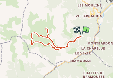
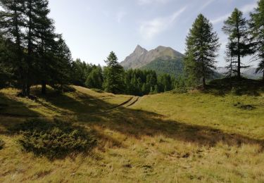
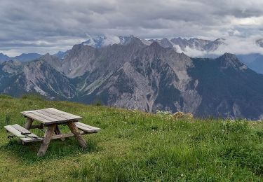
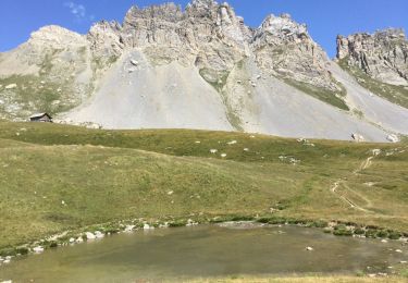
Trail Walking of 17 km to be discovered at Provence-Alpes-Côte d'Azur, Hautes-Alpes, Arvieux. This trail is proposed by amiral13.

Description

cette randonnée a été réalisée avec un enfant de 9 ans, le temps de parcours peut être donc être réduit.

Elevation profile

Photos

Positioning

Country:
France
Region :
Provence-Alpes-Côte d'Azur
Department/Province :
Hautes-Alpes
Municipality :
Arvieux
Location:
Unknown
Start:(UTM)
321768 ; 4955260 (32T) N.

Trails nearby

Trail Mountain bike Château-Ville-Vieille - Tour du Queyras - Photo
Mountain bike
tracegps

Mountain bike

Very difficult
(1)
Château-Ville-Vieille, Provence-Alpes-Côte d'Azur, Hautes-Alpes, France
32 km | 50 km-effort
3h 0min
Yes
Trail Snowshoes Arvieux - Arvieux- Col de Furfande - Photo
Snowshoes
meunier.ph.

Snowshoes

Easy
Arvieux, Provence-Alpes-Côte d'Azur, Hautes-Alpes, France
12.9 km | 26 km-effort
4h 6min
Yes
Trail Walking Arvieux - arvieux en boucle par furfande ( col et chalets) - Photo
Walking
tchoua

Walking

Easy
Arvieux, Provence-Alpes-Côte d'Azur, Hautes-Alpes, France
21 km | 38 km-effort
4h 40min
Yes
Trail Walking Château-Ville-Vieille - 05-pointe-du-Rasis-13km-760m-aout21 - Photo
Walking
SyMA

Walking

Difficult
Château-Ville-Vieille, Provence-Alpes-Côte d'Azur, Hautes-Alpes, France
13.2 km | 23 km-effort
5h 32min
Yes
Trail Walking Arvieux - Furfande - Photo
Walking
CAUBERTGENEVIEVE

Walking

Medium
Arvieux, Provence-Alpes-Côte d'Azur, Hautes-Alpes, France
12.6 km | 22 km-effort
7h 14min
No
Trail Snowshoes Arvieux - villardgaudin - Photo
Snowshoes
doumeherve

Snowshoes

Very easy
Arvieux, Provence-Alpes-Côte d'Azur, Hautes-Alpes, France
4.7 km | 7.8 km-effort
1h 37min
No
Trail Walking Arvieux - Com de Fontouse - Photo
Walking
Sorriaux

Walking

Difficult
Arvieux, Provence-Alpes-Côte d'Azur, Hautes-Alpes, France
8.6 km | 18.6 km-effort
3h 26min
Yes
Trail Walking Arvieux - 05 Le tour de la dent du Ratier Queyras - Photo
Walking
silvestreclaudine

Walking

Difficult
Arvieux, Provence-Alpes-Côte d'Azur, Hautes-Alpes, France
19.5 km | 34 km-effort
9h 23min
Yes
Trail Sled dogs Guillestre -  Charmousse. Ceillac  - Photo
Sled dogs
jeff2

Sled dogs

Difficult
Guillestre, Provence-Alpes-Côte d'Azur, Hautes-Alpes, France
9.9 km | 20 km-effort
3h 51min
No


Close
My subscriptions