Cucugnan Quéribus

emileverschueren
User
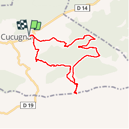

Length
9.3 km

Max alt
648 m

Uphill gradient
437 m
Km-Effort
15.1 km

Min alt
264 m

Downhill gradient
437 m
Boucle
Yes
Creation date :
2019-04-24 16:25:43.105
Updated on :
2019-04-24 16:25:43.151
3h14
Difficulty : Medium

FREE GPS app for hiking
 SityTrail
IGN / Geographical institutes
SityTrail Plus
The world is yours!
About
Trail Walking of 9.3 km to be discovered at Occitania, Aude, Cucugnan. This trail is proposed by emileverschueren.
Positioning
Country:
France
Region :
Occitania
Department/Province :
Aude
Municipality :
Cucugnan
Location:
Unknown
Start:(Dec)
Start:(UTM)
467766 ; 4744330 (31T) N.
Comments