


Baisse des 5 Lacs

trailer.nono
User

Length
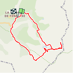
9.8 km

Max alt
2540 m

Uphill gradient
770 m
Km-Effort
20 km

Min alt
1815 m

Downhill gradient
775 m
Boucle
Yes
Creation date :
2018-04-16 22:22:57.332
Updated on :
2018-04-16 22:22:57.332
3h42
Difficulty : Easy

FREE GPS app for hiking
 SityTrail
IGN / Geographical institutes
SityTrail Plus
The world is yours!
About
Trail Walking of 9.8 km to be discovered at Provence-Alpes-Côte d'Azur, Maritime Alps, Saint-Martin-Vésubie. This trail is proposed by trailer.nono.
Positioning
Country:
France
Region :
Provence-Alpes-Côte d'Azur
Department/Province :
Maritime Alps
Municipality :
Saint-Martin-Vésubie
Location:
Unknown
Start:(Dec)
Start:(UTM)
368572 ; 4883620 (32T) N.
Comments