


beynac et cazenac

PhilippeC54
User
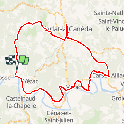

Length
43 km

Max alt
291 m

Uphill gradient
807 m
Km-Effort
54 km

Min alt
63 m

Downhill gradient
809 m
Boucle
Yes
Creation date :
2018-04-16 22:23:09.658
Updated on :
2018-04-16 22:23:09.658
4h08
Difficulty : Easy

FREE GPS app for hiking
 SityTrail
IGN / Geographical institutes
SityTrail Plus
The world is yours!
About
Trail Cycle of 43 km to be discovered at New Aquitaine, Dordogne, Beynac-et-Cazenac. This trail is proposed by PhilippeC54.
Positioning
Country:
France
Region :
New Aquitaine
Department/Province :
Dordogne
Municipality :
Beynac-et-Cazenac
Location:
Unknown
Start:(Dec)
Start:(UTM)
353443 ; 4967396 (31T) N.
Comments