Trail Walking Sainte-Cécile-d'Andorge - ste cécile d'andorge-portes - Photo

ste cécile d'andorge-portes

 ALDOMI30
ALDOMI30

User

© OpenStreetMap contributors
Length
Length
18.7 km
Max alt
Max alt
630 m
Uphill gradient
Uphill gradient
497 m
Km-Effort
Km-Effort  
25 km
Min alt
Min alt
289 m
Downhill gradient
Downhill gradient
496 m
Boucle
Boucle
Yes
Creation date :
2017-09-13 00:00:00.0
Updated on :
2022-06-21 14:57:38.11

(1 Reviews)

Walking
Walking
5h02
Difficulty : Difficult

Scan this QR Code to open this trail in the SityTrail application

FREE GPS app for hiking

Logo SityTrail SityTrail

IGN / Geographical institutes

Download SityTrail from the App Store Download SityTrail from Google Play

Logo SityTrail SityTrail World

The world is yours!

Download SityTrail from the App Store Download SityTrail from Google Play Download SityTrail on Huawei AppGallery

About

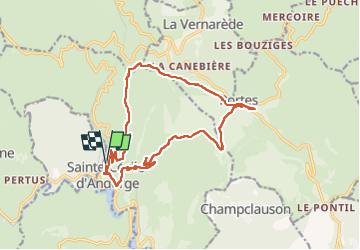
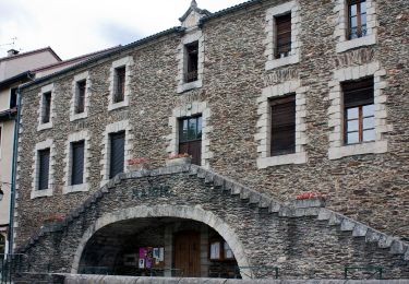
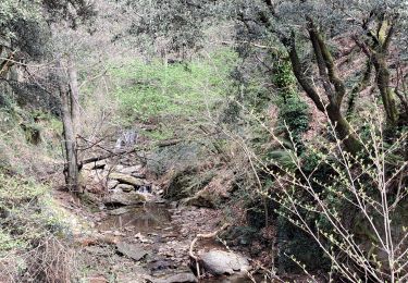
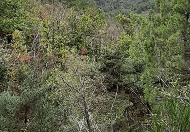
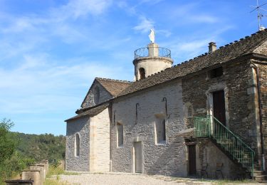
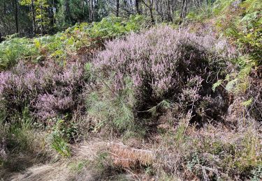
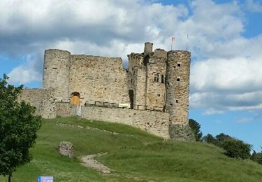
Trail Walking of 18.7 km to be discovered at Occitania, Gard, Sainte-Cécile-d'Andorge. This trail is proposed by ALDOMI30.

Description

Ggh

Elevation profile

Positioning

Country:
France
Region :
Occitania
Department/Province :
Gard
Municipality :
Sainte-Cécile-d'Andorge
Location:
Unknown
Start:(UTM)
577907 ; 4900635 (31T) N.

Comments

Please log in to post a review or rate the element


Trails nearby

Trail On foot Le Collet-de-Dèze - Sentier de découverte de Tignac - Photo
On foot
PRO

On foot

Easy
Le Collet-de-Dèze, Occitania, Lozère, France
3.6 km | 5.8 km-effort
1h 18min
No
Trail Walking Portes - Portes à Ste Cécile  - Photo
Walking
GUIDE
nadinebondoux

Walking

Medium
Portes, Occitania, Gard, France
18.1 km | 25 km-effort
5h 25min
No
Trail Walking Portes - Portes Sainte Cecile d ´Andorge - Photo
Walking
GUIDE
Roger Philippe Wallez

Walking

Very difficult
Portes, Occitania, Gard, France
19.6 km | 26 km-effort
5h 34min
Yes
Trail Walking Portes - 220929_Portes - Photo
Walking
fario

Walking

Difficult
Portes, Occitania, Gard, France
12.2 km | 16.6 km-effort
4h 54min
Yes
Trail Walking Portes - 220929_Portes - Photo
Walking
fario

Walking

Difficult
Portes, Occitania, Gard, France
12.2 km | 16.6 km-effort
4h 54min
Yes
Trail On foot Le Collet-de-Dèze - PR Sentier de Molières - Photo
On foot
PRO

On foot

Easy
Le Collet-de-Dèze, Occitania, Lozère, France
3.5 km | 4.7 km-effort
1h 4min
No
Trail Walking Portes - portes mu - Photo
Walking
fario

Walking

Difficult
Portes, Occitania, Gard, France
12.2 km | 16.6 km-effort
4h 54min
Yes
Trail Walking Sainte-Cécile-d'Andorge - SAINTE CÉCILE D'ANDORG - Photo
Walking
bernardgouttiere

Walking

Easy
Sainte-Cécile-d'Andorge, Occitania, Gard, France
6.9 km | 10.2 km-effort
2h 2min
Yes
Trail Other activity Portes - col de porte - Photo
Other activity
miloudominique

Other activity

Easy
Portes, Occitania, Gard, France
10.9 km | 14.1 km-effort
2h 21min
No


Close
My subscriptions