


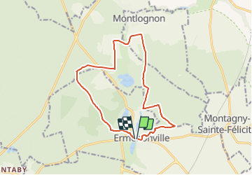
Ermenonville_Abbaye de Chaâlis / 13km_180mDEN

philberard95
User

Length
13.5 km

Max alt
127 m

Uphill gradient
181 m
Km-Effort
15.9 km

Min alt
63 m

Downhill gradient
184 m
Boucle
Yes
Creation date :
2017-09-23 00:00:00.0
Updated on :
2021-07-02 16:28:46.738
3h27
Difficulty : Unknown

FREE GPS app for hiking
 SityTrail
IGN / Geographical institutes
SityTrail Plus
The world is yours!
About
Trail Walking of 13.5 km to be discovered at Hauts-de-France, Oise, Ermenonville. This trail is proposed by philberard95.
Positioning
Country:
France
Region :
Hauts-de-France
Department/Province :
Oise
Municipality :
Ermenonville
Location:
Unknown
Start:(Dec)
Start:(UTM)
477633 ; 5441461 (31U) N.
Comments