


megeve jaillet

Robertplessier
User
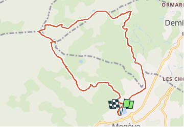

Length
11.7 km

Max alt
1758 m

Uphill gradient
672 m
Km-Effort
21 km

Min alt
1096 m

Downhill gradient
672 m
Boucle
Yes
Creation date :
2018-04-16 23:43:43.538
Updated on :
2022-11-08 10:56:14.895
3h40
Difficulty : Difficult

FREE GPS app for hiking
 SityTrail
IGN / Geographical institutes
SityTrail Plus
The world is yours!
About
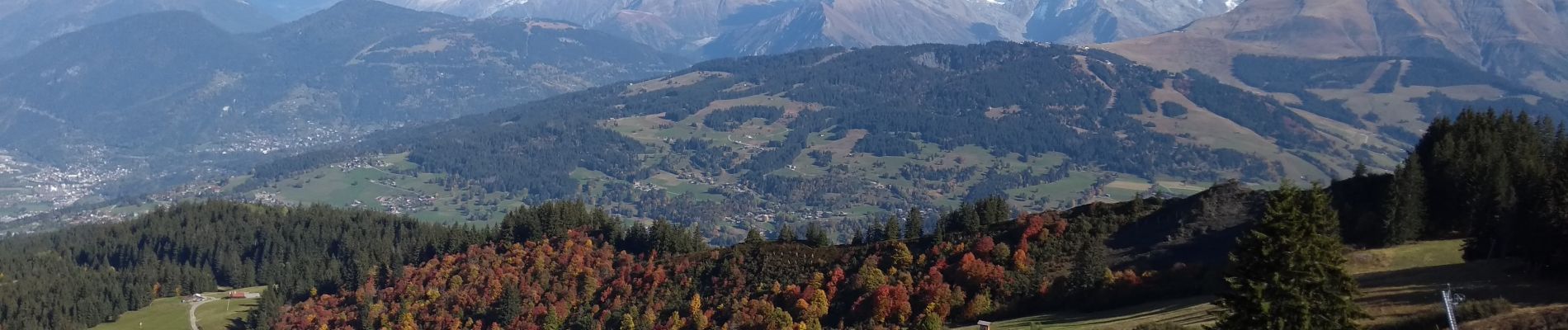
Trail Walking of 11.7 km to be discovered at Auvergne-Rhône-Alpes, Upper Savoy, Megève. This trail is proposed by Robertplessier.
Description
Jolie randonnée autour de Mégève
Photos


Positioning
Country:
France
Region :
Auvergne-Rhône-Alpes
Department/Province :
Upper Savoy
Municipality :
Megève
Location:
Unknown
Start:(Dec)
Start:(UTM)
314950 ; 5081171 (32T) N.
Comments