


COUTANCES CERENCES

UDGI54
User
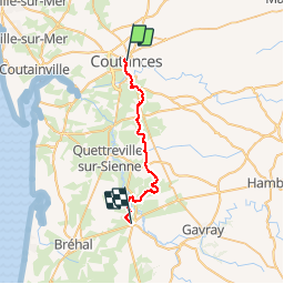

Length
23 km

Max alt
97 m

Uphill gradient
410 m
Km-Effort
29 km

Min alt
15 m

Downhill gradient
446 m
Boucle
No
Creation date :
2018-04-17 00:06:38.867
Updated on :
2018-04-17 00:06:38.867
--
Difficulty : Unknown

FREE GPS app for hiking
 SityTrail
IGN / Geographical institutes
SityTrail Plus
The world is yours!
About
Trail Walking of 23 km to be discovered at Normandy, Manche, Coutances. This trail is proposed by UDGI54.
Positioning
Country:
France
Region :
Normandy
Department/Province :
Manche
Municipality :
Coutances
Location:
Unknown
Start:(Dec)
Start:(UTM)
613636 ; 5433917 (30U) N.
Comments