


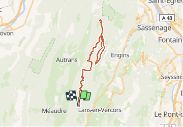
Col de La Croix Perrin - Plénouze - La Molière

maupassant38
User

Length
35 km

Max alt
1715 m

Uphill gradient
883 m
Km-Effort
47 km

Min alt
1224 m

Downhill gradient
882 m
Boucle
Yes
Creation date :
2019-02-22 22:30:49.306
Updated on :
2019-02-22 22:30:49.321
3h01
Difficulty : Medium

FREE GPS app for hiking
 SityTrail
IGN / Geographical institutes
SityTrail Plus
The world is yours!
About
Trail Mountain bike of 35 km to be discovered at Auvergne-Rhône-Alpes, Isère, Lans-en-Vercors. This trail is proposed by maupassant38.
Positioning
Country:
France
Region :
Auvergne-Rhône-Alpes
Department/Province :
Isère
Municipality :
Lans-en-Vercors
Location:
Unknown
Start:(Dec)
Start:(UTM)
701301 ; 5000620 (31T) N.
Comments