


Metz, Lac, Rivières et Monuments

edmondnagel
User

Length
29 km

Max alt
220 m

Uphill gradient
281 m
Km-Effort
33 km

Min alt
159 m

Downhill gradient
274 m
Boucle
No
Creation date :
2018-04-17 10:32:36.332
Updated on :
2018-04-17 10:32:36.332
--
Difficulty : Easy

FREE GPS app for hiking
 SityTrail
IGN / Geographical institutes
SityTrail Plus
The world is yours!
About
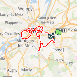
Trail Cycle of 29 km to be discovered at Grand Est, Moselle, Metz. This trail is proposed by edmondnagel.
Description
Un parcours facile permettant de découvrir les charmes de la ville de Metz
Positioning
Country:
France
Region :
Grand Est
Department/Province :
Moselle
Municipality :
Metz
Location:
Unknown
Start:(Dec)
Start:(UTM)
296960 ; 5442985 (32U) N.
Comments