


Marcilly-Chilly_S20171013

lemuid
User
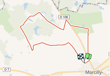

Length
9.4 km

Max alt
133 m

Uphill gradient
54 m
Km-Effort
10.1 km

Min alt
120 m

Downhill gradient
54 m
Boucle
Yes
Creation date :
2018-04-17 10:37:30.088
Updated on :
2018-04-17 10:37:30.088
1h47
Difficulty : Easy

FREE GPS app for hiking
 SityTrail
IGN / Geographical institutes
SityTrail Plus
The world is yours!
About
Trail Walking of 9.4 km to be discovered at Centre-Loire Valley, Loiret, Marcilly-en-Villette. This trail is proposed by lemuid.
Positioning
Country:
France
Region :
Centre-Loire Valley
Department/Province :
Loiret
Municipality :
Marcilly-en-Villette
Location:
Unknown
Start:(Dec)
Start:(UTM)
426249 ; 5290988 (31T) N.
Comments