


20171017-Fresne le Plan

doudet
User
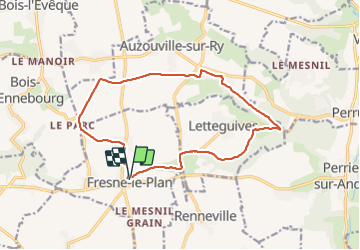

Length
13.9 km

Max alt
155 m

Uphill gradient
133 m
Km-Effort
15.7 km

Min alt
74 m

Downhill gradient
133 m
Boucle
Yes
Creation date :
2018-09-11 09:10:49.017
Updated on :
2018-09-11 09:10:49.017
3h42
Difficulty : Easy

FREE GPS app for hiking
 SityTrail
IGN / Geographical institutes
SityTrail Plus
The world is yours!
About
Trail Walking of 13.9 km to be discovered at Normandy, Seine-Maritime, Fresne-le-Plan. This trail is proposed by doudet.
Description
Boucle A-R au départ de L'Eglise
Positioning
Country:
France
Region :
Normandy
Department/Province :
Seine-Maritime
Municipality :
Fresne-le-Plan
Location:
Unknown
Start:(Dec)
Start:(UTM)
376434 ; 5474726 (31U) N.
Comments