


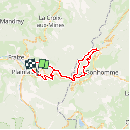
Plainfaing P5

PhilippeC54
User

Length
24 km

Max alt
1101 m

Uphill gradient
860 m
Km-Effort
35 km

Min alt
599 m

Downhill gradient
860 m
Boucle
Yes
Creation date :
2018-04-17 11:11:37.153
Updated on :
2018-04-17 11:11:37.153
2h16
Difficulty : Medium

FREE GPS app for hiking
 SityTrail
IGN / Geographical institutes
SityTrail Plus
The world is yours!
About
Trail Mountain bike of 24 km to be discovered at Grand Est, Vosges, Plainfaing. This trail is proposed by PhilippeC54.
Description
Col des Bagenelles
Positioning
Country:
France
Region :
Grand Est
Department/Province :
Vosges
Municipality :
Plainfaing
Location:
Unknown
Start:(Dec)
Start:(UTM)
353589 ; 5337084 (32U) N.
Comments