


sillon de talbert

eric.deniau
User

Length
19.6 km

Max alt
39 m

Uphill gradient
126 m
Km-Effort
21 km

Min alt
0 m

Downhill gradient
124 m
Boucle
Yes
Creation date :
2018-04-17 11:13:33.52
Updated on :
2018-04-17 11:13:33.52
4h36
Difficulty : Unknown

FREE GPS app for hiking
 SityTrail
IGN / Geographical institutes
SityTrail Plus
The world is yours!
About
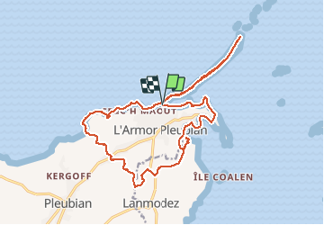
Trail Walking of 19.6 km to be discovered at Brittany, Côtes-d'Armor, Pleubian. This trail is proposed by eric.deniau.
Positioning
Country:
France
Region :
Brittany
Department/Province :
Côtes-d'Armor
Municipality :
Pleubian
Location:
Unknown
Start:(Dec)
Start:(UTM)
492536 ; 5412681 (30U) N.
Comments