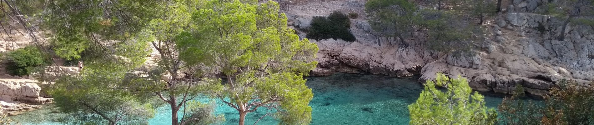
Trail Walking Cassis - cassis en vau - Photo
© OpenStreetMap contributors
Length
Length
9.3 km
Max alt
Max alt
137 m
Uphill gradient
Uphill gradient
475 m
Km-Effort
Km-Effort  
15.6 km
Min alt
Min alt
4 m
Downhill gradient
Downhill gradient
463 m
Boucle
Boucle
No
Creation date :
2018-04-17 11:29:10.026
Updated on :
2022-11-08 11:11:13.344

(0 Reviews)

Walking
Walking
4h01
Difficulty : Medium

Scan this QR Code to open this trail in the SityTrail application

FREE GPS app for hiking

Logo SityTrail SityTrail

IGN / Geographical institutes

Download SityTrail from the App Store Download SityTrail from Google Play

Logo SityTrail SityTrail Plus

The world is yours!

Download SityTrail from the App Store Download SityTrail from Google Play Download SityTrail on Huawei AppGallery

About

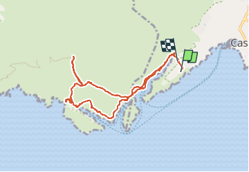
Trail Walking of 9.3 km to be discovered at Provence-Alpes-Côte d'Azur, Bouches-du-Rhône, Cassis. This trail is proposed by Robertplessier.

Description

Classique balade à en Vau à partir du parking de Cassis. Magnifique !!
(l'itinéraire passe par la descente directe du haut par le flanc de la calanque, interdit désormais, il faut faire le tour (suivre chemin  retour, également passage  en sortie de calanque à gauche pour monter au "trou du canon", magnifique, mais optionnel. Et également parcours du vallon d'en vau aller retour, optionnel aussi.

Elevation profile

Photos

Positioning

Country:
France
Region :
Provence-Alpes-Côte d'Azur
Department/Province :
Bouches-du-Rhône
Municipality :
Cassis
Location:
Unknown
Start:(UTM)
705004 ; 4787085 (31T) N.


Close
My subscriptions