


La Madeloc

rene06530
User
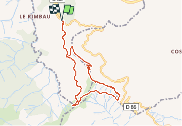

Length
9.4 km

Max alt
637 m

Uphill gradient
392 m
Km-Effort
14.7 km

Min alt
327 m

Downhill gradient
397 m
Boucle
Yes
Creation date :
2018-04-17 11:46:24.351
Updated on :
2018-04-17 11:46:24.351
3h18
Difficulty : Medium

FREE GPS app for hiking
 SityTrail
IGN / Geographical institutes
SityTrail Plus
The world is yours!
About
Trail Walking of 9.4 km to be discovered at Occitania, Pyrénées-Orientales, Collioure. This trail is proposed by rene06530.
Description
Col de la Serra, Madeloc, batterie 500, GR10, col de vallauria, col de la Serra.
Positioning
Country:
France
Region :
Occitania
Department/Province :
Pyrénées-Orientales
Municipality :
Collioure
Location:
Unknown
Start:(Dec)
Start:(UTM)
505338 ; 4705830 (31T) N.
Comments