


Estenc Mt PELAT

trailer.nono
User
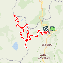

Length
29 km

Max alt
3013 m

Uphill gradient
1839 m
Km-Effort
53 km

Min alt
1913 m

Downhill gradient
1836 m
Boucle
Yes
Creation date :
2018-04-17 11:48:38.62
Updated on :
2018-04-17 11:48:38.62
7h05
Difficulty : Medium

FREE GPS app for hiking
 SityTrail
IGN / Geographical institutes
SityTrail Plus
The world is yours!
About
Trail Walking of 29 km to be discovered at Provence-Alpes-Côte d'Azur, Maritime Alps, Entraunes. This trail is proposed by trailer.nono.
Positioning
Country:
France
Region :
Provence-Alpes-Côte d'Azur
Department/Province :
Maritime Alps
Municipality :
Entraunes
Location:
Unknown
Start:(Dec)
Start:(UTM)
320797 ; 4901618 (32T) N.
Comments