


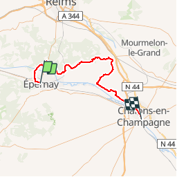
Epernay chalons

bruno38
User

Length
73 km

Max alt
281 m

Uphill gradient
1010 m
Km-Effort
86 km

Min alt
64 m

Downhill gradient
1007 m
Boucle
No
Creation date :
2018-04-17 12:34:59.087
Updated on :
2018-04-17 12:34:59.087
10m
Difficulty : Unknown

FREE GPS app for hiking
 SityTrail
IGN / Geographical institutes
SityTrail Plus
The world is yours!
About
Trail Other activity of 73 km to be discovered at Grand Est, Marne, Épernay. This trail is proposed by bruno38.
Positioning
Country:
France
Region :
Grand Est
Department/Province :
Marne
Municipality :
Épernay
Location:
Unknown
Start:(Dec)
Start:(UTM)
569619 ; 5432795 (31U) N.
Comments