


Blache Cotière

rigol05
User
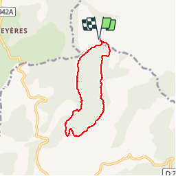

Length
5.6 km

Max alt
1191 m

Uphill gradient
258 m
Km-Effort
9 km

Min alt
934 m

Downhill gradient
258 m
Boucle
Yes
Creation date :
2018-04-17 13:35:54.941
Updated on :
2018-04-17 13:35:54.941
1h57
Difficulty : Easy

FREE GPS app for hiking
 SityTrail
IGN / Geographical institutes
SityTrail Plus
The world is yours!
About
Trail Walking of 5.6 km to be discovered at Provence-Alpes-Côte d'Azur, Hautes-Alpes, Rambaud. This trail is proposed by rigol05.
Positioning
Country:
France
Region :
Provence-Alpes-Côte d'Azur
Department/Province :
Hautes-Alpes
Municipality :
Rambaud
Location:
Unknown
Start:(Dec)
Start:(UTM)
270807 ; 4935489 (32T) N.
Comments