


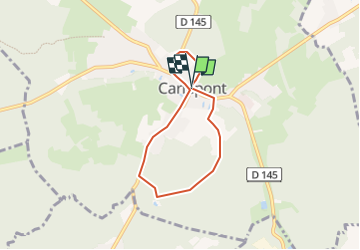
jp carlepont

NESTOR2714
User

Length
5 km

Max alt
89 m

Uphill gradient
62 m
Km-Effort
5.8 km

Min alt
53 m

Downhill gradient
62 m
Boucle
Yes
Creation date :
2018-04-17 13:45:24.506
Updated on :
2018-04-17 13:45:24.506
2h10
Difficulty : Unknown

FREE GPS app for hiking
 SityTrail
IGN / Geographical institutes
SityTrail Plus
The world is yours!
About
Trail Other activity of 5 km to be discovered at Hauts-de-France, Oise, Carlepont. This trail is proposed by NESTOR2714.
Positioning
Country:
France
Region :
Hauts-de-France
Department/Province :
Oise
Municipality :
Carlepont
Location:
Unknown
Start:(Dec)
Start:(UTM)
501898 ; 5484496 (31U) N.
Comments