


Serre d'Aumage

rigol05
User
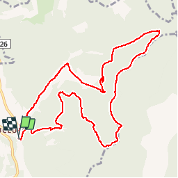

Length
12.1 km

Max alt
1280 m

Uphill gradient
465 m
Km-Effort
18.3 km

Min alt
868 m

Downhill gradient
462 m
Boucle
Yes
Creation date :
2018-04-17 13:46:37.95
Updated on :
2018-04-17 13:46:37.95
3h48
Difficulty : Easy

FREE GPS app for hiking
 SityTrail
IGN / Geographical institutes
SityTrail Plus
The world is yours!
About
Trail Walking of 12.1 km to be discovered at Provence-Alpes-Côte d'Azur, Hautes-Alpes, Montjay. This trail is proposed by rigol05.
Positioning
Country:
France
Region :
Provence-Alpes-Côte d'Azur
Department/Province :
Hautes-Alpes
Municipality :
Montjay
Location:
Unknown
Start:(Dec)
Start:(UTM)
708357 ; 4916849 (31T) N.
Comments