


St Offenge ch. Trousset

Bogapuki
User
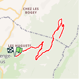

Length
11.7 km

Max alt
1198 m

Uphill gradient
542 m
Km-Effort
18.9 km

Min alt
692 m

Downhill gradient
540 m
Boucle
Yes
Creation date :
2018-11-25 09:18:52.469
Updated on :
2018-11-25 09:18:52.469
4h14
Difficulty : Very easy

FREE GPS app for hiking
 SityTrail
IGN / Geographical institutes
SityTrail Plus
The world is yours!
About
Trail Walking of 11.7 km to be discovered at Auvergne-Rhône-Alpes, Savoy, Saint-Offenge. This trail is proposed by Bogapuki.
Description
27 nov 2017
Aucune difficulté, pas de grand intérêt sauf pour une remise en jambes après un long arrêt d'activité. Possibilité de pique-nique dans le refuge.
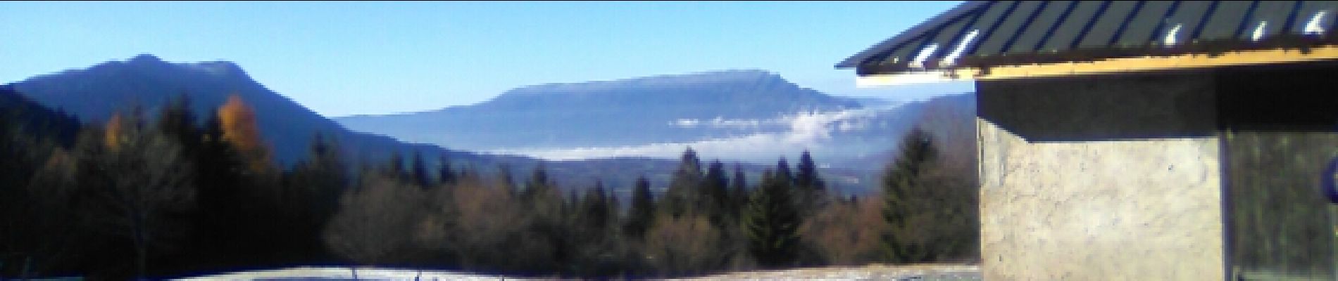
Photos


Positioning
Country:
France
Region :
Auvergne-Rhône-Alpes
Department/Province :
Savoy
Municipality :
Saint-Offenge
Location:
Saint-Offenge-Dessous
Start:(Dec)
Start:(UTM)
267644 ; 5068988 (32T) N.
Comments