


31.12.2017 - Reinhardsmunster

delm
User
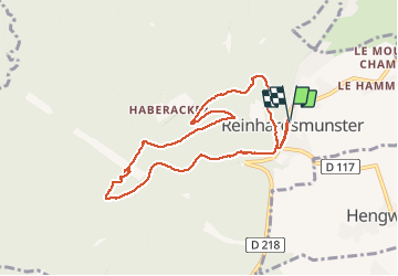

Length
8.2 km

Max alt
613 m

Uphill gradient
323 m
Km-Effort
12.6 km

Min alt
326 m

Downhill gradient
324 m
Boucle
Yes
Creation date :
2018-04-17 15:23:36.999
Updated on :
2018-04-17 15:23:36.999
2h17
Difficulty : Medium

FREE GPS app for hiking
 SityTrail
IGN / Geographical institutes
SityTrail Plus
The world is yours!
About
Trail Walking of 8.2 km to be discovered at Grand Est, Bas-Rhin, Reinhardsmunster. This trail is proposed by delm.
Description
Randonnée variée et très agréable avec quelques montées courte mais assez rude
Positioning
Country:
France
Region :
Grand Est
Department/Province :
Bas-Rhin
Municipality :
Reinhardsmunster
Location:
Unknown
Start:(Dec)
Start:(UTM)
376136 ; 5392898 (32U) N.
Comments