


20180106-darnetal

doudet
User
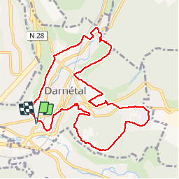

Length
10.6 km

Max alt
146 m

Uphill gradient
241 m
Km-Effort
13.8 km

Min alt
20 m

Downhill gradient
241 m
Boucle
Yes
Creation date :
2018-09-11 09:10:43.387
Updated on :
2018-09-11 09:10:43.387
2h57
Difficulty : Unknown

FREE GPS app for hiking
 SityTrail
IGN / Geographical institutes
SityTrail Plus
The world is yours!
About
Trail Other activity of 10.6 km to be discovered at Normandy, Seine-Maritime, Darnétal. This trail is proposed by doudet.
Positioning
Country:
France
Region :
Normandy
Department/Province :
Seine-Maritime
Municipality :
Darnétal
Location:
Unknown
Start:(Dec)
Start:(UTM)
365514 ; 5477983 (31U) N.
Comments