


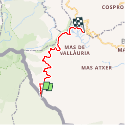
Col de Banyuls/Col des gascons

CANON2
User

Length
8.8 km

Max alt
430 m

Uphill gradient
223 m
Km-Effort
11.7 km

Min alt
311 m

Downhill gradient
193 m
Boucle
No
Creation date :
2019-05-15 13:07:45.45
Updated on :
2019-05-15 13:07:45.557
2h51
Difficulty : Unknown

FREE GPS app for hiking
 SityTrail
IGN / Geographical institutes
SityTrail Plus
The world is yours!
About
Trail Walking of 8.8 km to be discovered at Occitania, Pyrénées-Orientales, Banyuls-sur-Mer. This trail is proposed by CANON2.
Description
aller/retour 18kms
Positioning
Country:
France
Region :
Occitania
Department/Province :
Pyrénées-Orientales
Municipality :
Banyuls-sur-Mer
Location:
Unknown
Start:(Dec)
Start:(UTM)
504466 ; 4699758 (31T) N.
Comments