


Mayaud-St Gens

MarcLEBARON
User
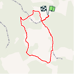

Length
8.5 km

Max alt
661 m

Uphill gradient
344 m
Km-Effort
13.1 km

Min alt
386 m

Downhill gradient
345 m
Boucle
Yes
Creation date :
2018-04-17 16:33:21.242
Updated on :
2018-04-17 16:33:21.242
2h09
Difficulty : Easy

FREE GPS app for hiking
 SityTrail
IGN / Geographical institutes
SityTrail Plus
The world is yours!
About
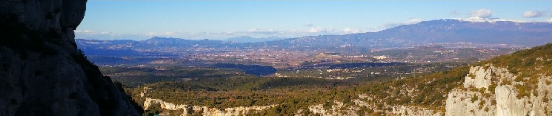
Trail Walking of 8.5 km to be discovered at Provence-Alpes-Côte d'Azur, Vaucluse, Venasque. This trail is proposed by MarcLEBARON.
Description
Boucle
Photos


Positioning
Country:
France
Region :
Provence-Alpes-Côte d'Azur
Department/Province :
Vaucluse
Municipality :
Venasque
Location:
Unknown
Start:(Dec)
Start:(UTM)
672894 ; 4870819 (31T) N.
Comments