


W - 2018 - 06 Change Saint Jean

clabidault
User
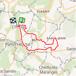

Length
12.8 km

Max alt
470 m

Uphill gradient
327 m
Km-Effort
17.2 km

Min alt
261 m

Downhill gradient
331 m
Boucle
Yes
Creation date :
2018-04-17 17:11:57.159
Updated on :
2018-12-31 14:40:38.164
3h41
Difficulty : Medium

FREE GPS app for hiking
 SityTrail
IGN / Geographical institutes
SityTrail Plus
The world is yours!
About
Trail Walking of 12.8 km to be discovered at Bourgogne-Franche-Comté, Saône-et-Loire, Change. This trail is proposed by clabidault.
Description
Ciel couvert 24 participants
Positioning
Country:
France
Region :
Bourgogne-Franche-Comté
Department/Province :
Saône-et-Loire
Municipality :
Change
Location:
Unknown
Start:(Dec)
Start:(UTM)
624340 ; 5198553 (31T) N.
Comments