Trail Walking Mauges-sur-Loire - saint Laurent de la plaine  - Photo
 louis49
louis49

User

© OpenStreetMap contributors
Length
Length
9.7 km
Max alt
Max alt
116 m
Uphill gradient
Uphill gradient
83 m
Km-Effort
Km-Effort  
10.8 km
Min alt
Min alt
79 m
Downhill gradient
Downhill gradient
81 m
Boucle
Boucle
Yes
Creation date :
2018-04-17 17:24:42.502
Updated on :
2018-04-17 17:24:42.502

(0 Reviews)

Walking
Walking
2h31
Difficulty : Easy

Scan this QR Code to open this trail in the SityTrail application

FREE GPS app for hiking

Logo SityTrail SityTrail

IGN / Geographical institutes

Download SityTrail from the App Store Download SityTrail from Google Play

Logo SityTrail SityTrail World

The world is yours!

Download SityTrail from the App Store Download SityTrail from Google Play Download SityTrail on Huawei AppGallery

About

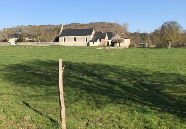
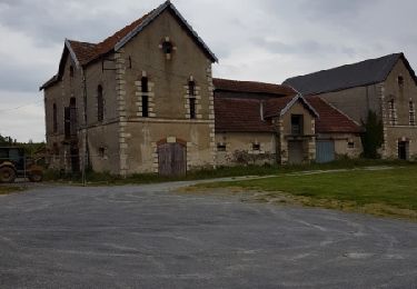
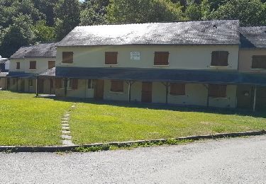
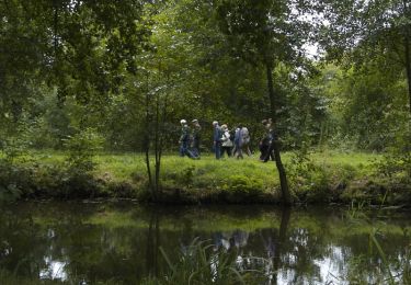
Trail Walking of 9.7 km to be discovered at Pays de la Loire, Maine-et-Loire, Mauges-sur-Loire. This trail is proposed by louis49.

Elevation profile

Photos

Positioning

Country:
France
Region :
Pays de la Loire
Department/Province :
Maine-et-Loire
Municipality :
Mauges-sur-Loire
Location:
Unknown
Start:(UTM)
665989 ; 5242644 (30T) N.

Trails nearby

Trail Walking Mauges-sur-Loire - La pommeraye 11 km 500 - Photo
Walking
001684.da93e47b4c1543cdba58b05a314a4094.1618

Walking

Difficult
Mauges-sur-Loire, Pays de la Loire, Maine-et-Loire, France
13.3 km | 16.3 km-effort
3h 23min
No
Trail Walking Mauges-sur-Loire - Saint Laurent de la plaine  - Photo
Walking
louis49

Walking

Very easy
Mauges-sur-Loire, Pays de la Loire, Maine-et-Loire, France
9.7 km | 10.8 km-effort
2h 31min
Yes
Trail Walking Mauges-sur-Loire - La Pommeraye - Photo
Walking
louis49

Walking

Medium
Mauges-sur-Loire, Pays de la Loire, Maine-et-Loire, France
10.2 km | 12 km-effort
2h 50min
Yes
Trail Walking Chalonnes-sur-Loire - sentier de l'Armange. - Photo
Walking
louis49

Walking

Medium
Chalonnes-sur-Loire, Pays de la Loire, Maine-et-Loire, France
11.7 km | 14.3 km-effort
3h 11min
Yes
Trail Walking Chalonnes-sur-Loire - Vallée du Layon - Corniche Angevine - Photo
Walking
tracegps

Walking

Difficult
(2)
Chalonnes-sur-Loire, Pays de la Loire, Maine-et-Loire, France
20 km | 24 km-effort
6h 0min
Yes
Trail Mountain bike Chalonnes-sur-Loire - Espace VTT FFC des Côteaux du Layon - Circuit n° 03 - Saint Vincent - Photo
Mountain bike
tracegps

Mountain bike

Medium
Chalonnes-sur-Loire, Pays de la Loire, Maine-et-Loire, France
11.9 km | 14.3 km-effort
1h 0min
Yes
Trail Mountain bike Chalonnes-sur-Loire - Espace VTT FFC des Côteaux du Layon - Circuit n° 01 - Corniche Angevine - Photo
Mountain bike
tracegps

Mountain bike

Difficult
Chalonnes-sur-Loire, Pays de la Loire, Maine-et-Loire, France
15.2 km | 18.5 km-effort
1h 30min
Yes
Trail Walking Chalonnes-sur-Loire - SityTrail - 771882 - sentier-de-lxarmangex - Photo
Walking
bubuserge

Walking

Difficult
(3)
Chalonnes-sur-Loire, Pays de la Loire, Maine-et-Loire, France
11.7 km | 14.3 km-effort
3h 15min
Yes
Trail Walking Mauges-sur-Loire - SityTrail - La Pommeraye sentier des moulins Chateaupanne - Photo
Walking

Walking

Difficult
Mauges-sur-Loire, Pays de la Loire, Maine-et-Loire, France
11.7 km | 14 km-effort
3h 11min
Yes


Close
My subscriptions