


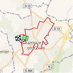
Dammartin RS 7.9 km

GOELERANDO2
User

Length
7.9 km

Max alt
179 m

Uphill gradient
148 m
Km-Effort
9.8 km

Min alt
108 m

Downhill gradient
148 m
Boucle
Yes
Creation date :
2018-04-17 17:57:04.222
Updated on :
2018-04-17 17:57:04.222
2h30
Difficulty : Easy

FREE GPS app for hiking
 SityTrail
IGN / Geographical institutes
SityTrail Plus
The world is yours!
About
Trail Other activity of 7.9 km to be discovered at Ile-de-France, Seine-et-Marne, Dammartin-en-Goële. This trail is proposed by GOELERANDO2.
Description
Parking et départ au cimetière rue Eugène Hémar 77230 Dammartin en Goële
Positioning
Country:
France
Region :
Ile-de-France
Department/Province :
Seine-et-Marne
Municipality :
Dammartin-en-Goële
Location:
Unknown
Start:(Dec)
Start:(UTM)
476251 ; 5433644 (31U) N.
Comments