


2011-10-30 - 11h51m54

domifon
User
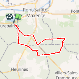

Length
14.5 km

Max alt
214 m

Uphill gradient
277 m
Km-Effort
18.1 km

Min alt
37 m

Downhill gradient
277 m
Boucle
Yes
Creation date :
2014-12-10 00:00:00.0
Updated on :
2014-12-10 00:00:00.0
2h47
Difficulty : Medium

FREE GPS app for hiking
 SityTrail
IGN / Geographical institutes
SityTrail Plus
The world is yours!
About
Trail Nordic walking of 14.5 km to be discovered at Hauts-de-France, Oise, Beaurepaire. This trail is proposed by domifon.
Photos


Positioning
Country:
France
Region :
Hauts-de-France
Department/Province :
Oise
Municipality :
Beaurepaire
Location:
Unknown
Start:(Dec)
Start:(UTM)
469484 ; 5460133 (31U) N.
Comments