


puybrun bilhac

bellouelo46
User
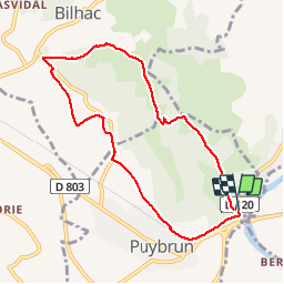

Length
8.1 km

Max alt
267 m

Uphill gradient
153 m
Km-Effort
10.1 km

Min alt
139 m

Downhill gradient
160 m
Boucle
Yes
Creation date :
2018-04-17 18:26:53.586
Updated on :
2018-04-17 18:26:53.586
1h55
Difficulty : Very easy

FREE GPS app for hiking
 SityTrail
IGN / Geographical institutes
SityTrail Plus
The world is yours!
About
Trail Walking of 8.1 km to be discovered at Occitania, Lot, Puybrun. This trail is proposed by bellouelo46.
Description
promenade
Positioning
Country:
France
Region :
Occitania
Department/Province :
Lot
Municipality :
Puybrun
Location:
Unknown
Start:(Dec)
Start:(UTM)
405203 ; 4974972 (31T) N.
Comments