


Clair de lune Etangs de Comelle

GOELERANDO2
User
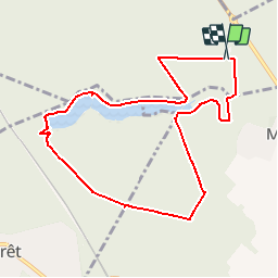

Length
8.9 km

Max alt
86 m

Uphill gradient
90 m
Km-Effort
10.1 km

Min alt
45 m

Downhill gradient
90 m
Boucle
Yes
Creation date :
2018-04-17 20:38:23.821
Updated on :
2018-04-17 20:38:23.821
2h14
Difficulty : Medium

FREE GPS app for hiking
 SityTrail
IGN / Geographical institutes
SityTrail Plus
The world is yours!
About
Trail Walking of 8.9 km to be discovered at Hauts-de-France, Oise, Chantilly. This trail is proposed by GOELERANDO2.
Description
Parking et départ de l'aire de pique nique de la table de Montgrésin (60)
Positioning
Country:
France
Region :
Hauts-de-France
Department/Province :
Oise
Municipality :
Chantilly
Location:
Unknown
Start:(Dec)
Start:(UTM)
464084 ; 5445634 (31U) N.
Comments