


04-03-2018 - Grendelbruch

delm
User
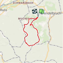

Length
9.9 km

Max alt
835 m

Uphill gradient
230 m
Km-Effort
12.9 km

Min alt
668 m

Downhill gradient
229 m
Boucle
Yes
Creation date :
2018-04-17 20:52:05.95
Updated on :
2018-04-17 20:52:05.95
2h37
Difficulty : Easy

FREE GPS app for hiking
 SityTrail
IGN / Geographical institutes
SityTrail Plus
The world is yours!
About
Trail Walking of 9.9 km to be discovered at Grand Est, Bas-Rhin, Grendelbruch. This trail is proposed by delm.
Description
Randonnée très sympathique sans trop de difficultés
Positioning
Country:
France
Region :
Grand Est
Department/Province :
Bas-Rhin
Municipality :
Grendelbruch
Location:
Unknown
Start:(Dec)
Start:(UTM)
374827 ; 5372092 (32U) N.
Comments