


F757-St Dié- Massif de la Madeleine

geranimo
User
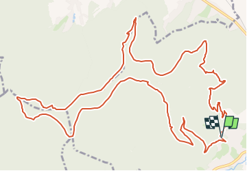

Length
16.7 km

Max alt
670 m

Uphill gradient
558 m
Km-Effort
24 km

Min alt
363 m

Downhill gradient
564 m
Boucle
Yes
Creation date :
2018-04-17 21:25:27.785
Updated on :
2025-02-01 18:00:42.533
5h29
Difficulty : Difficult

FREE GPS app for hiking
 SityTrail
IGN / Geographical institutes
SityTrail Plus
The world is yours!
About
Trail Walking of 16.7 km to be discovered at Grand Est, Vosges, Saint-Dié-des-Vosges. This trail is proposed by geranimo.
Positioning
Country:
France
Region :
Grand Est
Department/Province :
Vosges
Municipality :
Saint-Dié-des-Vosges
Location:
Unknown
Start:(Dec)
Start:(UTM)
344832 ; 5350101 (32U) N.
Comments