


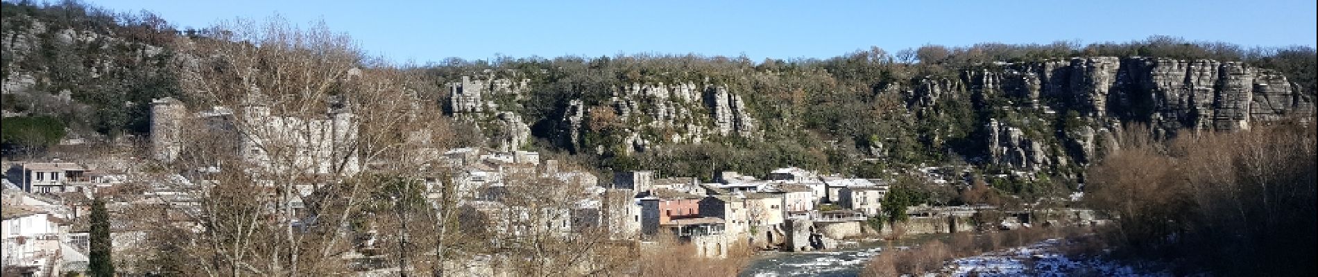
Voguë - Les Chazes - Le Serre

JPC83
User
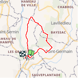

Length
13.1 km

Max alt
329 m

Uphill gradient
272 m
Km-Effort
16.8 km

Min alt
148 m

Downhill gradient
269 m
Boucle
Yes
Creation date :
2018-04-17 21:28:32.658
Updated on :
2018-04-17 21:28:32.658
5h21
Difficulty : Unknown

FREE GPS app for hiking
 SityTrail
IGN / Geographical institutes
SityTrail Plus
The world is yours!
About
Trail Other activity of 13.1 km to be discovered at Auvergne-Rhône-Alpes, Ardèche, Vogüé. This trail is proposed by JPC83.
Photos


25 photos in total. Please click on a photo to see them all in the gallery.


Positioning
Country:
France
Region :
Auvergne-Rhône-Alpes
Department/Province :
Ardèche
Municipality :
Vogüé
Location:
Unknown
Start:(Dec)
Start:(UTM)
612313 ; 4933767 (31T) N.
Comments