


Haute Kontz

patign
User
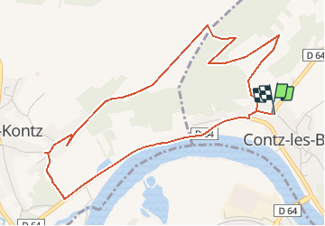

Length
5.4 km

Max alt
256 m

Uphill gradient
127 m
Km-Effort
7.1 km

Min alt
142 m

Downhill gradient
125 m
Boucle
Yes
Creation date :
2018-04-17 21:30:36.275
Updated on :
2018-04-17 21:30:36.275
1h32
Difficulty : Easy

FREE GPS app for hiking
 SityTrail
IGN / Geographical institutes
SityTrail Plus
The world is yours!
About
Trail Walking of 5.4 km to be discovered at Grand Est, Moselle, Contz-les-Bains. This trail is proposed by patign.
Positioning
Country:
France
Region :
Grand Est
Department/Province :
Moselle
Municipality :
Contz-les-Bains
Location:
Unknown
Start:(Dec)
Start:(UTM)
307531 ; 5481381 (32U) N.
Comments