


marcilly

lemuid
User
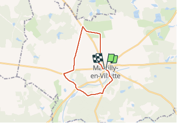

Length
10.5 km

Max alt
135 m

Uphill gradient
75 m
Km-Effort
11.5 km

Min alt
109 m

Downhill gradient
77 m
Boucle
Yes
Creation date :
2018-04-17 21:55:32.536
Updated on :
2018-04-17 21:55:32.536
2h00
Difficulty : Easy

FREE GPS app for hiking
 SityTrail
IGN / Geographical institutes
SityTrail Plus
The world is yours!
About
Trail Walking of 10.5 km to be discovered at Centre-Loire Valley, Loiret, Marcilly-en-Villette. This trail is proposed by lemuid.
Positioning
Country:
France
Region :
Centre-Loire Valley
Department/Province :
Loiret
Municipality :
Marcilly-en-Villette
Location:
Unknown
Start:(Dec)
Start:(UTM)
426708 ; 5290573 (31T) N.
Comments