


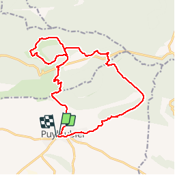
de puyloubier à la sinne

Coryphene
User

Length
19.9 km

Max alt
776 m

Uphill gradient
660 m
Km-Effort
29 km

Min alt
340 m

Downhill gradient
665 m
Boucle
Yes
Creation date :
2018-04-17 22:10:10.615
Updated on :
2019-09-24 16:24:10.627
5h47
Difficulty : Medium

FREE GPS app for hiking
 SityTrail
IGN / Geographical institutes
SityTrail Plus
The world is yours!
About
Trail Walking of 19.9 km to be discovered at Provence-Alpes-Côte d'Azur, Bouches-du-Rhône, Puyloubier. This trail is proposed by Coryphene.
Photos

Positioning
Country:
France
Region :
Provence-Alpes-Côte d'Azur
Department/Province :
Bouches-du-Rhône
Municipality :
Puyloubier
Location:
Unknown
Start:(Dec)
Start:(UTM)
715998 ; 4822665 (31T) N.
Comments