


r

fra_depoorter
User
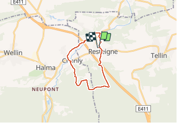

Length
9.6 km

Max alt
389 m

Uphill gradient
263 m
Km-Effort
13.1 km

Min alt
179 m

Downhill gradient
263 m
Boucle
Yes
Creation date :
2018-04-17 22:16:57.659
Updated on :
2018-04-17 22:16:57.659
1h58
Difficulty : Unknown

FREE GPS app for hiking
 SityTrail
IGN / Geographical institutes
SityTrail Plus
The world is yours!
About
Trail Walking of 9.6 km to be discovered at Wallonia, Luxembourg, Tellin. This trail is proposed by fra_depoorter.
Positioning
Country:
Belgium
Region :
Wallonia
Department/Province :
Luxembourg
Municipality :
Tellin
Location:
Resteigne
Start:(Dec)
Start:(UTM)
655584 ; 5550271 (31U) N.
Comments